- Printed on Polypropylene (plastic)
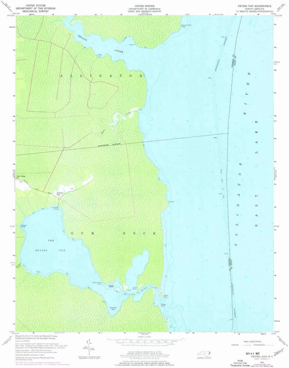
- USGS topographic map of Frying Pan, NC, at 1:24000 scale. Heavier material. Waterproof. Tear-resistant. Foldable. Perfect for the outdoors.
- Cities, towns, villages: Frying Pan
- Islands: Crane Island
- Parks and forests: National Parks, National Forests, etc. Please preview map image for specifics.
USGS topographic map of Frying Pan, North Carolina, dated 1953, updated 1977.
Includes geographic coordinates (latitude and longitude), lines of elevation, bodies of water, roads, and more. This topo quad is suitable for recreational, outdoor uses, office applications, or wall map framing.
Printed on-demand by YellowMaps on the print material of your choice.
Shipping rolled from Minneapolis, MN, United States.
Product Number: USGS-5370544
Map Size: 26.8 inches high x 21.9 inches wide
Map Scale: 1:24000
Map Type: POD USGS Topographic Map
Map Series: HTMC
Map Version: Historical
Cell ID: 16550
Scan ID: 161442
Imprint Year: 1977
Woodland Tint: Yes
Photo Revision Year: 1974
Aerial Photo Year: 1974
Field Check Year: 1953
Survey Year: 1951
Datum: NAD27
Map Projection: Polyconic
Map published by United States Department of Commerce
Map Language: English
Scanner Resolution: 600 dpi
Map Cell Name: Frying Pan
Grid size: 7.5 X 7.5 Minute
Date on map: 1953
Geographical region: North Carolina, United States
Northern map edge Latitude: 35.875°
Southern map edge Latitude: 35.75°
Western map edge Longitude: -76.125°
Eastern map edge Longitude: -76°
Surrounding map sheets (copy & paste the Product No. in the search bar):
North: USGS-5370470,USGS-5370472
East: USGS-5369332,USGS-5369334,USGS-5369336
South: USGS-5370340,USGS-5370342,USGS-5370336,USGS-5370338
West: USGS-5373180,USGS-5373178


